First Trail Released
By Matthew Hilton, DirtScan Founder
I’m pleased to announce that the first trail, Jurassic is now viewable on DirtScan, you can view it by clicking the image below.
This is one of my favourite local trails, and am very pleased to see it to now be viewable in 3D, right in your web browser.
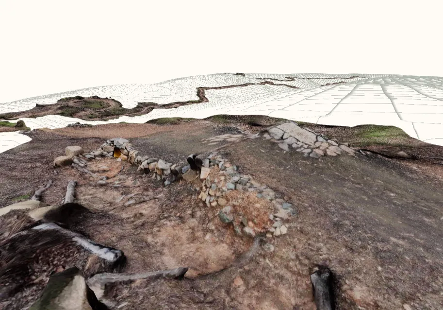
This is a huge step forward in the project, as now there is a complete end to end process for creating these trails and having them be viewed by everyone.
What’s next
This is just the beginning. The viewer in particular is quite basic at the moment, the goal is to have:
- Foliage: trees are removed in the model as they are not scanned well, but I’d like to add them back in some shape or form as they are important to know about. Additionally, I want to add other foliage to create a forest atmosphere, that matches the environment of the actual trail.
- Highlight points of interest, and allow easy navigation between. Also show fireroads/access information.
- Simulated riding the trail, with option to pause, analyze, and get reference sizes of features, show a/b lines.
Ride safe! ⛰️ 🚴
Matt